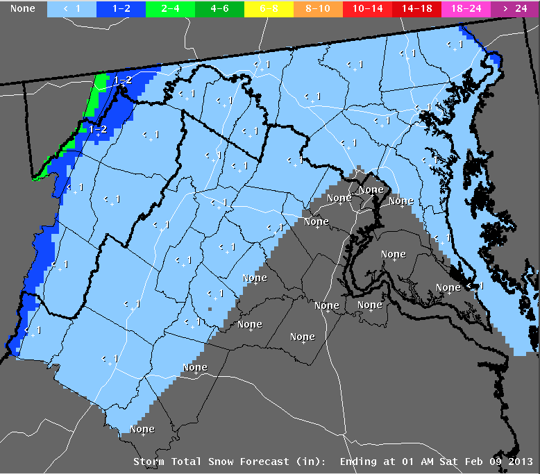
Again, like last Saturday evening's dusting of snow, when traffic was heavy, just trace amounts of wintery precip can create all manor of havoc to traffic and pedestrian traffic in this region. Hopefully road crews will pre-treat before the morning rush. It's all timing, timing, timing...
The second major story is the development of a powerful Nor'easter off the Carolina Coast tomorrow night. This is the same storm that will bring us light precipitation tomorrow. As it moves offshore, then northeast off the coast (passing by the Delmarva shore) it will literally "bomb out" off the New England coast...bringing a bona fide blizzard to coastal New England... with up to 2 feet of snow and winds gusting in the 50-60 mph range. Not good for travel, nor for keeping the lights and heat on. It will be a close scrape on the very backside of the storm for us. Winds from the west-southwest will increase here Friday night into Saturday morning - possibly reaching Wind Advisory criteria at higher elevations to our west and northwest.
Here are the forecast maps showing this enormously powerful storm, which The Weather Channel is calling Winter Storm Nemo:
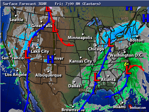 |
| Forecast map, Friday 7 AM, showing coastal low developing off Hatteras. We pick up light precipitation on the northwest side of the storm, as it slides out to sea. |
 |
| Forecast map, 7 PM Friday. Nor'easter Nemo is rapidly deepening off the New England coast - pummeling the region with heavy snow and high, sustained winds. Conditions become breezy but clearing over Baltimore. |
No comments:
Post a Comment